Colorado-Utah 2010 Trip - Days 20, 21, and 22

Wednesday, June 9th to Friday, June 11th – The Trip Home

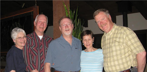
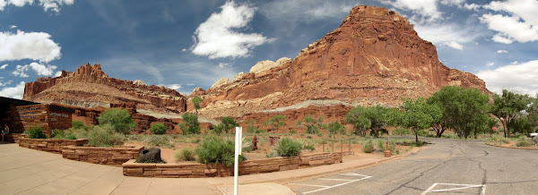
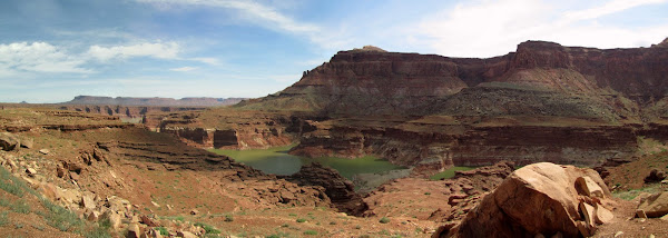
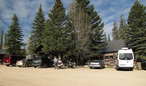
Well, they say "all good things must come to an end" and that especially true for vacations.  My friend's K12LT had developed a front fork seal leak during our ride in Utah, and he was understandably reluctant to ride it, once we returned to his house, since it was continuing to leak fork oil down to the brake caliper on that side.  He was also quickly consumed with work again (he is an independent contractor for a large aerospace-defense company).


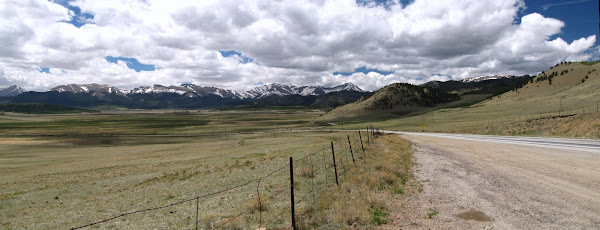
On Day 20, I was up around 4:30 a.m. and on the road by around 5 a.m. MDT (about a half hour before dawn) with hopes of get a lot of riding done before the afternoon thunderstorms developed on the Kansas plains.  Day one of the trip home would take me from Parker, CO to Columbia, MO, about 712 miles on mostly I-70.

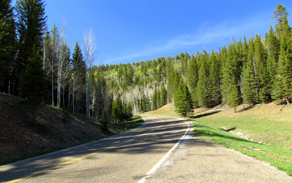
The first hour's ride on Colorado Highway 86 was great, over the open rolling foothills, watching the sun come up.  After that, it was many hours droning eastward along on I-70.  I made a quick gas and breakfast stop in Colby, Kansas, and moved along.  The day's ride was enjoyable, other than a traffic tie-up in Kansas City, which left me sitting at 90 degrees for longer than I would have liked.  I arrived at my first day's destination in east Columbia, Missouri, around 6 p.m. CDT.


View Larger Map


The Day 21 ride (552 miles) took me from Columbia, Missouri to Corbin, Kentucky.  Once again, I was up early and rolling by 5 a.m., so I try to could be around St. Louis before the morning commuter traffic.  I was successful and stopped just east of St. Louis, in Illinois, for breakfast.  The day quickly became hot.  After entering Kentucky and stopping for gas, I considered making a side trip to see a bourbon distillery, Maker's Mark, that I had visited the year before during the BMW MOA Rally, but decided against doing so.  I moved on and arrived at my second day's destination, Corbin, Kentucky, around 5:30 p.m. EDT.


View Larger Map


Day 22, the final day of the trip, took me from Corbin to Wilmington (523 miles).  I enjoyed a pleasant ride to Knoxville, Tennessee and through the North Carolina mountains to Asheville.  I finally stopped after Hendersonville, NC, for gas -- a 3 hour, 15 minute, 214 mile run.  The weather turned hot, especially after I went through Charlotte, which was already 93 degrees by 11 a.m.  By the time I reached Rockingham, it was 97 degrees.  I remembered how much more tolerable these temperatures seemed while I was in Colorado and Utah, because of their much lower humidity!  I finally arrived home shortly after 3 p.m.

It was the end of a wonderful trip.  21 days and 6,510 miles.  For those of you who are interested, you can browse a more comprehensive collection of my trip photos on my Google Picasa web album.

Colorado-Utah 2010 Trip - Days 17, 18, and 19

Sunday, June 6th through Tuesday, June 8th ‑ Parker, CO

On Sunday evening, John, Betsy, and I had dinner at the home of their friends, Steve and Suzanne Weston.  The Westons are also motorcyclists (both of them ride BMW R1200RTs).  I have had the pleasure of seeing Steve and Suzanne on several of my trips to Denver, as well as when attending a couple of the BMW MOA national rallies.


I spent the remaining days visiting with my friends, John and Betsy.  John and I had dirty laundry which needed washing (a big thank you to Betsy!), pictures to swap, and John had work to catch up on starting Monday.  


We spent a couple of evenings grilling out, watching the deer and foxes running on the fairway behind their house, and admiring the sunsets over the Rocky Mountains.


On Tuesday, I packed up the bike and prepared for the trip home.

Colorado-Utah 2010 Trip - Day 16

Saturday, June 5th – Grand Junction, CO to Denver, CO
After breakfast, John and I headed east on I-70.  Our first destination was Glenwood Springs, Colorado, 85 miles eastward, where a huge boulder came crashing down during the winter and destroyed both lanes of I-70.  The damaged section of the interstate has only recent been reopened (and is reportedly still one-lane traffic through that section).  It was a pleasant ride as we followed I-70 as it wound its way alongside the Colorado River.

After a fill-up in Glenwood Springs, we headed south on CO 82 toward Aspen.  The mountainsides were quickly filled with Firs, and later Aspens, as we gained altitude.  As we approached Aspen, I could understand its popularity ‑ the area is beautiful.  Aspen itself is a very developed and picturesque area, with very little of the urban "clutter" you normally see in cities (i.e., no McDonalds', very discrete gas stations, and such).  Aspen is also filled with a lot of very expensive real estate ‑ enough said.

After a very brief stop in Aspen, we began the climb up the road to head up and over Independence Pass.  We stopped a few times on our way up to the pass to take photos.


Independence Pass was still closed when we began our trip to Utah and did not open until Memorial Day weekend.  I think this picture will explain why.


After enjoying the cool, 58 degree weather at the top of Independence Pass, we headed down the switchbacks on the east side, stopping later to look back toward where we had just ridden from.


We continued our ride, stopping in Buena Vista for lunch, before heading northward on CO 285 toward Fairplay.  We rode through a gorgeous high plains valley (the valley was at approximately 9,000 feet) with the Rocky Mountains all around us.  At the north end, we paused again to take a few pictures.


The remainder of the ride home took us through more great mountain roads and scenery.  We arrived back at John and Betsy's house around  4 p.m.  It was time for a shower, drinks, and grilling out.

Colorado-Utah 2010 Trip - Day 15

Friday, June 4th – Monticello, UT to Grand Junction, CO


Our original plan was to visit the south end of Canyonlands National Park, then head toward Gunnison, Colorado. 

Since would be a shorter day's ride, we allowed ourselves to sleep in until around 6 a.m.  We headed down to enjoy the hotel's "continental breakfast," then packed up the bikes and checked out.  After a quick fill-up, we headed north out of Monticello, on Highway 191.  It was only 14 miles or so before we turned onto the road that would take us into the south end of Canyonlands National Park.

Canyonlands National Park is a region of canyons cut by the Colorado and the Green Rivers, and has three, distinct, and quite different regions.  Only two of the areas are accessible by paved roads.  The south end of Canyonlands is called The Needles District; the north end is called Island in the Sky District, and the western area is called The Maze District.

The ride into The Needles District was beautiful, but it would be 32 miles before we would actually enter Canyonlands National Park.  Initially, we rode through open sagebrush-filled terrain, after which we rode through a few switchbacks that carried us down into a canyon.  Along the way, we briefly stopped for a few pictures.


As we approached the entrance to Canyonlands, we were able to see several beautiful mesas on the way.


It's only 9 miles from the south entrance of Canyonlands to the end of the paved road.  The south end of Canyonlands was scenic, with many interesting rock formations.  One example was Wooden Shoe Rock.


The south end of the park includes another interesting formation known as The Needles, which consists of a large number of needle-like spires of rocks.


At the end of the road into the south end of Canyonlands, we stopped for a few minutes to take pictures of some of the rock formations.  Off in the distance, we could see the mesas which are located at the north end of Canyonlands.


After taking pictures, we started our ride out of the south end of Canyonlands.  About half way back out of Canyonlands, we stopped at a location we bypassed on the in ‑ Newspaper Rock National Historic Site.  This turned out to be a fascinating stop.  The Newspaper Rock National Historic Site is a well-covered 200 square foot rock under a sandstone cliff.  The rock is covered with hundreds of Native American petroglyphs.  Some date back nearly 2000 years, while others are much more recent.


We returned to Highway 191, then headed north toward Moab.  Along the way, we spied another arch along the road side and stopped to take a couple of pictures.


By this time (11:00 a.m. or so), the temperatures in the low 90s and climbing.  We moved on to Moab, where we stopped once again at the Moab Brewery, this time for lunch.  It was a welcomed break from the 95 degree heat.  After lunch and a fill-up, we headed northward to the Island in the Sky District of Canyonlands.

In the Island of the Sky district, you are on top of the mesa and looking down into some of the canyons cut by the rivers.  The views are incredible.


The Shafer Trail is a dirt road that you can take around the rim of some of the canyons, if you have a four-wheel drive vehicle.  Maybe on another trip....


By late afternoon, we were hot and getting tired, so we headed back to Highway 191 for the ride north to I-70 and the 80 mile trip east to Grand Junction, Colorado.  It was a hot (95 degree plus) and windy ride along I-70.  We arrived at the hotel, showered, and walked to dinner.  It had been another great day's ride, and we concluded that we definitely made the right decision to tour both ends of Canyonlands National Park rather than only the south end and then heading to Gunnison (which was even hotter that day).

Tomorrow, the trip back to Denver.

Colorado-Utah 2010 Trip - Day 14

Thursday, June 3rd – Kanab, UT to Monticello, UT


We started this day's knowing it would be long (440 miles) and long, especially with the three major stops we had planned at Bryce Canyon National Park, Capital Reef National Park, and Natural Bridges National Monument.  We left Kanab shortly after 6 a.m., taking Utah 189 north through Glendale, Utah, until we reached Utah 12.  Turning onto Utah 12, we soon encountered a gorgeous area called Red Canyon State Park.


After a few quick pictures, we moved on to our breakfast stop at the Bryce Canyon Pines Restaurant, located a few miles south of the entrance into Bryce Canyon National Park.  Bryce Canyon has hundreds of hoodoos ‑ pillars of rock, and fins ‑ thin ridges of rocks, formed from the eroding canyon walls.  Bryce Canyon forms the top of what is referred to as the Grand Staircase of plateaus that start of the Grand Canyon, and extend through several ranges of cliffs, Zion Canyon, and several more ranges of cliffs until Bryce Canyon.  The formations are breathtaking.  We first stopped at Sunrise and Sunset Points.


We rode further into Bryce Canyon park, eventually reaching the end at Rainbow Point.


As wonderful as the scenery was, we knew we still had a lot of miles to cover that day, so we headed out of the park and continued eastward on Utah 12.  Our ride along Utah 12 took us along the edge of the Grand Staircase-Escalante National Monument.  We stopped at an overlook on Utah 12 which look out over a "badlands-like area that was amazing.


After this stop, the road took us through a series of twisting switchbacks down into and through this area of badlands.  The views were incredible.


At one spot along Highway 12, we rode a short section of road where the road twisted back-and-forth with no guard rails and drop-offs of several hundred feet on either side ‑‑ all you could see was a ribbon of road in front of you!  A bit later, we climbed back into mountains, the temperatures cooled, and we returned to seeing Spruce and Douglas Firs.  We briefly stopped to look back at the area we had just pass through.


We moved on to where Highway 12 meets Highway 24, at Torrey, where we stopped for a late lunch and fill-up.  There we met a gentlemen, probably in his mid-60s, that we passed earlier on Highway 12.  He was riding a Triumph Bonneville.  We chatted with him at lunch, learning that that he was from Mississippi and was returning from a trip to Sacramento to visit his sister.  We parted ways with him as we headed out to Capital Reef National Park.  

Highway 24 passes through Capital Reef National Park.  The park runs mostly north-south along a fold of sedimentary rock that uplifted 65 million years ago.


An interesting formation, known as The Castle, can been seen from outside the Visitor's Center on Utah 24.


Utah 24 continued along the Freemont River along the canyon it has cut.  At Hanksville, we pulled in for a quick break.  At the gas station, we again met the fellow from Mississippi (he had passed us while we were stopped at the Capitol Reef Visitor's Center).  The three of us headed out together, turning south on Utah 95.  This section of riding took us by some amazing views of the mesas.  We eventually reached the Glen Canyon National Recreational Area, a large man-made lake (Lake Powell) formed on the Colorado River.  We pulled off for pictures (of course).


Only a mile or so further down the road, we spotted a better overlook and stopped again for pictures.  In the distance, we could see the bridge across the Colorado River.


We pushed on, crossing the Colorado River and riding through another section of badlands and mesas that were amazing and beautiful.  About 40 miles after crossing the Colorado, we came upon the entrance to Natural Bridges National Monument.  We parted ways with our riding companion from Mississippi, and headed into the monument.  We managed to stop at the visitor's center only three minutes before closing to buy our park pins, and headed out for the 9‑mile one-way drive loop.  Because it was now late in the day (well after 6 p.m., the lighting was not favorable for photographing the three natural bridges (we found ourselves facing into the sun at two of the three stops).


It was after 7 p.m. before we finished touring Natural Bridges, and 40 mile ride to Blanding, Utah and then another 20 miles after that to Monticello.  We stopped for dinner at a restaurant in Blanding, but it was dark by the time we finished eating.  We arrived at our hotel in Monticello around 9 p.m., after a near miss encounter with a herd of deer shortly after passing the "Deer Migration Area" sign!

The scenery on the day's ride was incredible, and despite the day being long and very hot (a high of 97 degrees while in the Glen Canyon area), this was probably the best one-day's ride I have ever had!

Colorado-Utah 2010 Trip - Day 13

Wednesday, June 2nd) – Kanab, UT (Grand Canyon)


We pulled out from Kanab around 6 a.m., heading for Grand Canyon National Park.  After passing through Kanab and Frieda, we heading across the flatlands which were filled with sagebrush, before reaching the hills climbing into Kaibab National Forest.  As we entered the National Forest, we briefly stopped at a scenic viewpoint to photograph the mesa back in the direction we had just come from.


We continued through the Kaibab National Forest, encountering numerous mule deer along the way.  Just prior to entering Grand Canyon National Park, we passed large meadows and stopped at the Kaibab Lodge for breakfast.


After breakfast, we entered Grand Canyon National Park and drove gradually downward through forests of Ponderosa Pines and Douglas Firs.  


We finally reached the Grand Canyon Lodge on the north rim, parked, and walked through the lodge to the porches on the back side.  My first viewing was breathtaking -- it was so much more immense than I had imagined.


We spent a couple of hours sightseeing from several of the overlooks at the Grand Canyon Lodge.  Afterwards, we rode to the Point Imperial and Cape Royal overlooks also.


We returned to the lodge for a late afternoon lunch and John's 20-minute power nap.  We spent another hour or two sitting at viewing areas around the lodge, before starting the trip back to Kanab, Utah.  We returned to Kanab after 8 p.m., had some ice cream at a local shop, and made preparations for another early-morning start. 

Without a doubt, the Grand Canyon was the high point of the trip, thus far.

Colorado-Utah 2010 Trip - Day 12

Tuesday, June 1st ‑ Salt Lake City, UT to Kanab, UT


In order to avoid the morning commuter traffic, we were on the road by 6 a.m. on Tuesday morning. Our ride would take us south on Interstate 15 for several hours.  About 50 miles south of Provo, we stopped in Nephi, Utah, for a good old country-style breakfast at Lisa's Country Kitchen Restaurant.  I discovered that western biscuits are not the same as southern biscuits!  You simply cannot get a biscuit to rise when you are cooking them at 6,000 feet elevation.

We continued south on I-15, with the posted speed limit varying between 75 mph and 80 mph.  At those speeds, you can cover a lot of distance and we were able to travel the 315 miles from Salt Lake City to Hurricane, Utah in about five hours driving time.  We reached Hurricane, Utah, around mid-day and stopped for a sandwich before heading into Zion National Park.  Because of the number of annual visitors, and the fact that the park is essentially one road that extends into a canyon, the National Park Service runs a shuttle bus ferries visitors into and out of the canyon.  Unfortunately, my pictures cannot portray how beautiful the canyon was.


One especially interesting spot was the Weeping Rock.  This was a cliff where water was dripping out of the cliff side.  Rain percolates through the sandstone layers at the top, until the water encounters a layer of shale.  The shale forces the water to travel laterally until it reaches the edge of the cliff , where it rains down on the area below.  The dripping water has allowed for a variety of plant life to grow on the nearly vertical rocks.  It looked like a sort of Hanging Gardens of Babylon.


After touring Zion National Park, we continued westward on UT 9, through an approximately one mile tunnel that was built as part of the WPA projects of the 1930s.  For safety reasons, they only allow traffic to pass through the tunnel one-way at a time.  Emerging from the tunnel, we passed some amazing sandstone formations where you could see all types of folding of the rock layers.  Unfortunately, there were limited safe spots to pull of the road to take pictures of them.

Later, we turned onto US 89 toward Kanab.  Along the way, we stopped along the highway to admire the scenery.


Tomorrow, we head to the Grand Canyon.

Colorado-Utah 2010 Trip - Days 10 and 11

Sunday, May 30th and Monday, May 31st ‑ Salt Lake City, UT


We spent the next two days enjoying the racing activities at Miller Motorsports Park.  Since we had purchased a special ticket package offered through BMW, we were able to take advantage of VIP parking near our grandstand seats, as well as enjoy a specially catered lunch at the BMW hospitality tent each day.


Sunday was spent mainly watching the racers in the various classes doing practice laps.  They ran one race class that afternoon, a GT class.  During the lunch period on both Sunday and Monday, the pit lane area was opened to allow the fans the opportunity to walk through and see the race teams at work.


The World Superbike qualifying sessions were also held on Sunday.  The qualifying was run in three sessions, which sets the starting order for slots 9 through 16, then 5 through 8, and finally 1 through 4.  Monday was the big event -- the World Superbike races.  The racing was amazing.  I have watched the World Superbike races on television; however, until you can actually see them in person, you cannot appreciate how fast these riders are really going!